India-Based Data Entry Outsourcing Support Serving USA, Canada, UK, Australia, Europe, New Zealand, Singapore, UAE
Property Records Data Entry

Property Records Data Entry for Parcel and Real Estate Databases

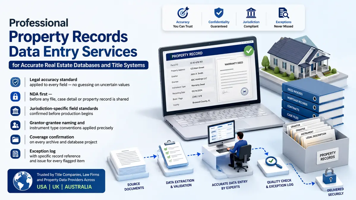
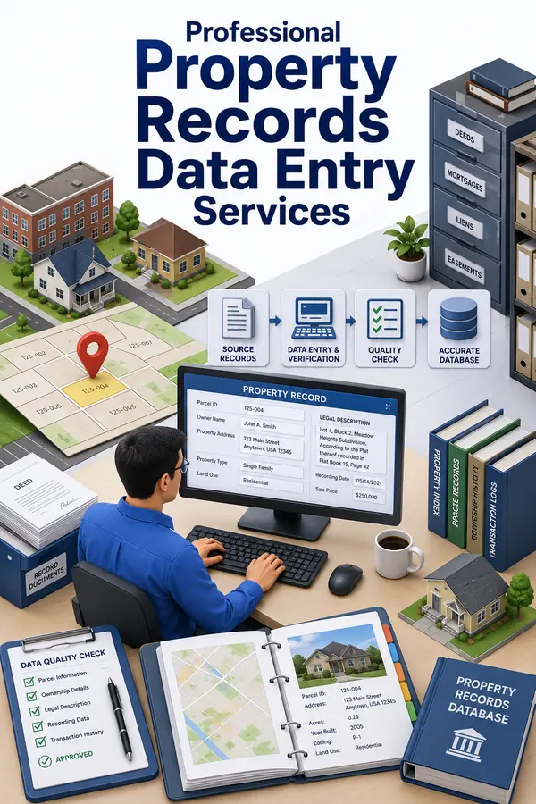
Property records describe land, improvements, ownership references, assessments and recorded events across time. Our service turns approved public and client-owned sources into structured parcel-level records.

The delivery team captures supported facts from assessor files, tax records, deeds, maps, legal descriptions and supplied databases. Title, legal and valuation interpretation remains with authorised client personnel.

Data companies, government contractors and real estate teams can outsource parcel backlogs or recurring updates when coverage and traceability matter. Each material entry preserves its source jurisdiction, document reference and effective date.

Shri Data Entry Services team working on Property Records Data Entry Services projects
5000+ Completed Projects
90% Returning Clients
16+ Years Experience
45+ Countries Served
50+ Professionals Team
Services We Offer

Keep jurisdiction, parcel, owner reference and recorded evidence in the correct relationship

  • Jurisdiction identified
  • Parcel format protected
  • Source date retained
  • Owner names captured faithfully
  • Instrument references linked
  • Legal interpretation excluded

An address alone is not a safe property identifier. Parcels may contain several situs addresses, addresses may change and one owner may hold many parcels. The jurisdiction’s parcel or assessment identifier therefore anchors the capture model where available.

Sources are not interchangeable. An assessor record may describe current assessment data, a deed may record a transfer instrument and a tax file may show billing information. The controlled workflow keeps those meanings and effective dates distinct.

Clients can assign high-volume capture while qualified researchers decide title implications, ownership conflicts and legal-description interpretation. The output contains evidence-linked records rather than unsupported property conclusions.

Parcel-level capture across assessment, tax, deed and jurisdictional records

Each record retains the source context needed for later verification.

01

Assessor and parcel data entry

Parcel IDs, situs addresses, use codes, land and improvement facts, assessment values and visible jurisdiction fields are captured under supplied definitions.

02

Property tax record capture

Tax year, assessed amounts, billed amounts, status fields and account references are entered without interpreting liability or advising on tax status.

03

Owner and mailing record entry

Names and mailing addresses are transcribed from approved sources with entity distinctions and source dates retained.

04

Deed and instrument reference indexing

Book, page, instrument number, recording date and supported party references are connected to the parcel without making a title determination.

05

Structure Parcel Legal Descriptions

Lot, block, subdivision, section and other supplied description text is captured faithfully; ambiguous boundaries return to specialist review.

06

Recurring jurisdiction updates

New or changed public records follow a scheduled collection, comparison, effective-date and exception workflow.

Property Software Compatibility

Property Records Data Entry: Direct Integration and Software Compatibility

Outputs are prepared around the field structure, controlled values and import requirements of your destination environment. Files can be delivered for review, staging or authorised import without forcing your team to rebuild the completed work.

Supported destinations

Property and transaction records aligned to operational systems

Files are mapped to the client’s approved template, naming rules, identifiers and system structure before full production begins.

  • YardiProperty and tenant import fields
  • AppFolioListings and management records
  • BuildiumProperty and lease structures
  • MRI SoftwareAsset and portfolio fields
  • SalesforceProperty CRM objects
  • Custom SQLProperty staging tables
Source continuity

References stay connected

Source IDs, filenames, record keys and approved relationships remain available for review and downstream traceability.

Import control

Fields are mapped before production

Mandatory fields, formats, controlled values, character limits and relationship keys are checked against the destination specification.

Pilot validation

Test the handoff with a representative batch

Rejected rows, unsupported values and mapping conflicts are returned with exact references so approved corrections can be incorporated before full-volume delivery.

Delivery formatsStructured for review, staging or import
  • CSV
  • XLSX
  • XML

Column order, encoding, date rules, multi-value handling and destination-specific requirements can follow the receiving system’s approved specification.

Compatibility means SDES prepares outputs to specifications supplied or approved by the client. Product names identify commonly used destination systems and do not imply endorsement, certification or partnership.

Process, Quality and Security

A jurisdiction-aware route from public source to parcel database

1. Define the Jurisdiction Model

Parcel formats, source systems, update frequency and field meanings are documented.

2. Rank the Sources

Assessor, recorder, tax and client files are assigned to the fields they actually support.

3. Pilot Identity Variations

Split parcels, changed addresses, multi-owner records and missing IDs test the guide.

4. Capture Parcel Facts With Jurisdictional Provenance

The delivery team retains jurisdiction, source, date and document references.

5. Check Parcel Relationships

Identifiers, addresses, parties and instruments are reviewed without unsupported merging.

6. Deliver Records and Research Holds

Usable records and title or boundary questions remain separate.

📂 Source formats we accept
  • County recorder portal records and documents
  • Title plant system exports for update processing
  • Scanned deed and instrument images
  • Property data service feeds for verification
  • Assessor database exports and tax roll data
📤 Delivery formats
  • Title plant and property database import files
  • Ownership and transaction history spreadsheets
  • Assessment data update files
  • Multi-county property database files
  • Exception and verification flags

Parcel identifiers are stored as jurisdictional identifiers, protecting leading zeroes, separators and format distinctions.

Owner, address, value and status fields retain the source and effective date needed to understand when the observation applied.

Reviewers identify conflicting parcels, parties and instruments but do not make title, boundary or tax conclusions.

🔒 NDA Protected Before files are shared
🌐 GDPR Aware EU data handling
Defined Quality Target Confirmed by pilot
🛡️ Secure Transfer Encrypted file access
📋 Exception Log Every delivery
👥 Project Team Only Controlled access
Free accuracy test

Need property records entered accurately at scale?

Share your property record types, source documents and database format. We process a free pilot batch so you can verify field accuracy and system format before committing to full production.

✓ No credit card required✓ No contract required✓ 24–48 hour return
Get a Free Pilot Batch
Source sampleyour_sample_data.csv
Received
Verified deliveryverified_output.xlsx
Reviewed
▣ Encrypted transfer◉ Quality controlled
Why Outsource to SDES?

Why property databases need evidence dates as much as values

Property Records Data Entry Services workflow and quality review
  • Jurisdiction-specific rules
  • Parcel-ID protection
  • Source-date traceability
  • Instrument linkage
  • Identity exception queues
  • Capacity for multi-jurisdiction coverage

Property capture can scale without confusing a public-record observation with a legal conclusion.

The documented workflow keeps each value tied to the jurisdiction and source that supported it, making updates and disputes easier to investigate.

Start Your Project →
Industries We Support

Property records data for real estate and public-record operations

Property Data Providers

Multi-jurisdiction parcel databases built from traceable public and licensed sources.

Government and Contractors

Assessment, tax and recorder backlogs structured under jurisdictional rules.

Mortgage and Risk Operations

Approved property facts prepared for collateral and portfolio workflows.

Title and Legal Services

Instrument and parcel indexes support qualified research without replacing it.

Case Studies

Relevant Project Experience

County Assessor Backfile Conversion

Project Name
County Assessor Backfile Conversion
Volume
412,000 parcel records — completed in 10 weeks
Problem
Historical files used changing parcel formats and mixed land/improvement fields.
Solution
The mapping preserved original IDs, added format versions and separated unsupported relationships.
Outcome
The county contractor received reconciled records with traceable legacy exceptions.
Title
Public Records Programme Manager
Industry
Government Services
Country
United States

Multi-Jurisdiction Property Dataset

Project Name
Multi-Jurisdiction Property Dataset
Volume
1.9 million parcel observations — completed in 11 weeks
Problem
Source dates, use codes and address conventions differed across jurisdictions.
Solution
The delivery team applied jurisdiction profiles and retained local values alongside approved standard fields.
Outcome
The data provider gained comparable coverage without erasing source-specific meaning.
Title
Property Data Operations Lead
Industry
Real Estate Information
Country
Canada

Recorded Instrument Index Recovery

Project Name
Recorded Instrument Index Recovery
Volume
286,000 deed and lien references — completed in 4 weeks
Problem
Instrument images lacked consistent parcel links and party spellings varied.
Solution
Match tiers used supplied parcel and recording evidence; uncertain links remained unassigned.
Outcome
Searchability improved without presenting possible matches as title facts.
Title
Records Index Manager
Industry
Title Services
Country
Australia
FAQs

Parcel Sources, Jurisdiction Fields and Title-Boundary Questions

Can you determine legal ownership from public records?

No. We capture supported record facts; title and legal ownership conclusions remain with qualified personnel.

How do you handle parcel-number format changes?

Original values and format context are protected, with approved crosswalks applied separately.

Can each field retain its public-record source?

Yes. Jurisdiction, source type, date and document reference can be included where required.

Can Property Records Data Entry Services follow our existing template or platform fields?

Yes, when the destination fields, accepted values, identifiers and permitted actions are confirmed. Delivery can be prepared as Title plant and property database import files, Ownership and transaction history spreadsheets, with unresolved records excluded from upload-ready output.

📩 Get a Free Pilot Batch
💬